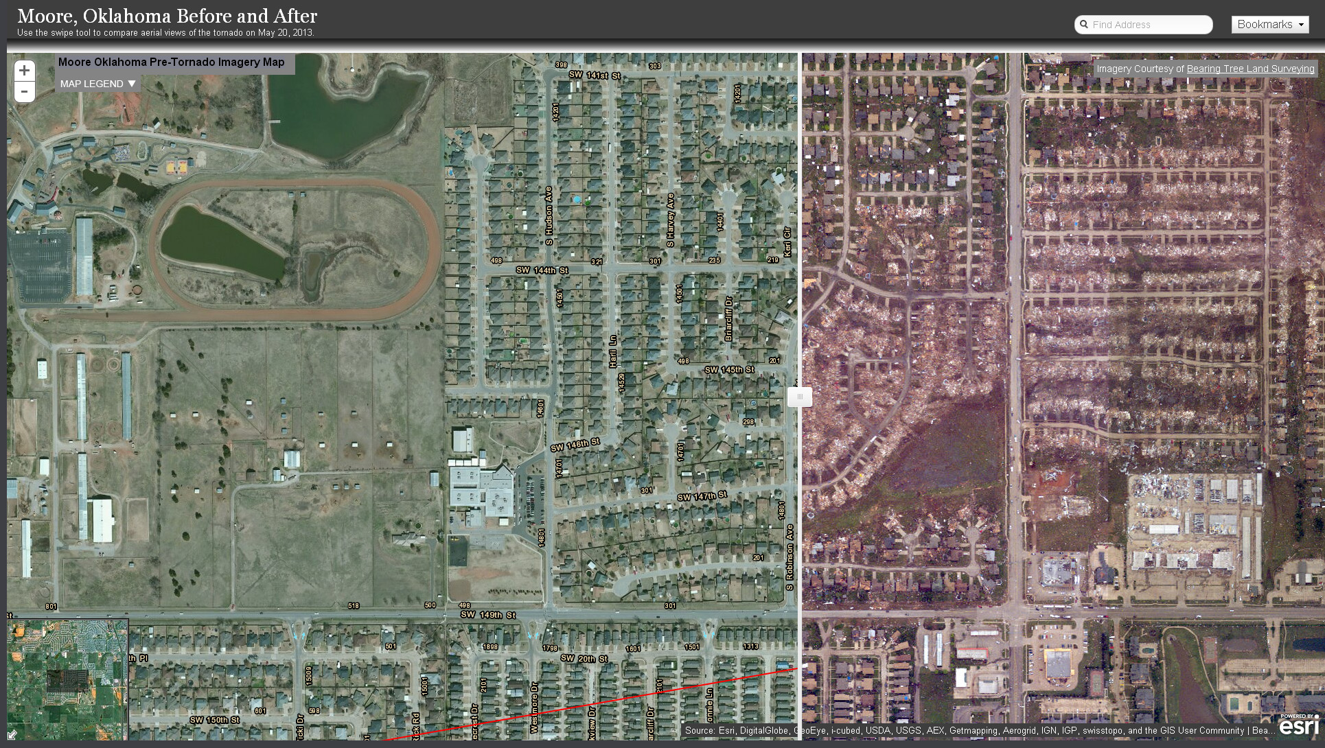
Click here to View before and after satellite images of the area affected by the Moore, Oklahoma tornado of May 2013 using the new Google Crisis Response map. Slimply go back and forth with a slider to instantly compare post and pre-tornadic images of Moore, OK.
Also click here to view specific sites affected by the storm. Just slide the bar from side-to-side to see before and after photos.


